


The Victoria Concert Hall excavation site. (Credit: Lim Chen Sian)
The Victoria Concert Hall is located on the northern bank of the Singapore River, and sits within the commercial heart of modern and colonial Singapore, as well as the ancient settlement of 14th century Temasek. Built in honor of Queen Victoria, the Victoria Memorial Hall (c.1905) was erected next to the old Town Hall (c.1862); a clock tower was later added in 1909 between the two buildings, and in 1979 the Memorial Hall was renamed as the Victoria Concert Hall (VCH).
In order to evaluate and explore the potential archaeological reservoir of the VCH site, a team led by Mr. Lim Chen Sian (SEASP, ISEAS) conducted a trial excavation in June 2010. The trial excavation yielded a significant amount of artifacts; enough to warrant a large-scale salvage excavation in September 2011 prior to further construction development. The team excavated a segment of the construction impact zone along Old Parliament Lane, recovering some 600kg of artifacts that would have otherwise been lost to the bulldozers. The salvage excavation was jointly organized by the Singapore Heritage Society, the Department of Southeast Asian Studies (National University of Singapore), and the Archaeology Unit (ISEAS – Yusof Ishak Institute).

An excavation pit at the Victoria Concert Hall site. (Credit: Lim Chen Sian)
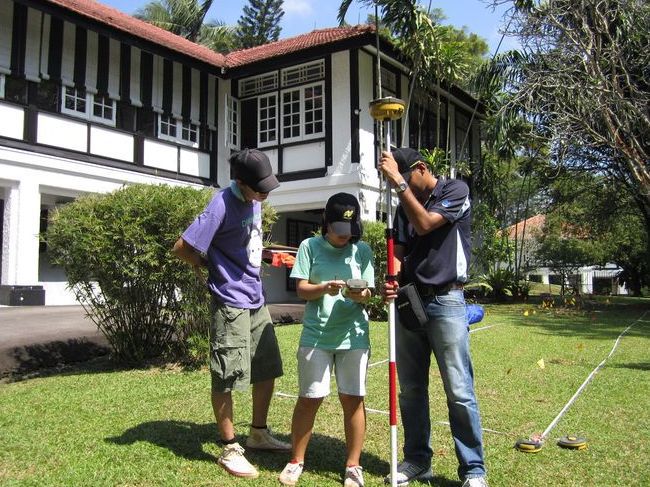
During World War II, one of the largest coastal artillery emplacements in the British Empire was located in Singapore. A pair of 15-inch battleship guns were emplaced in the Buona Vista-Ulu Pandan region. After the war the guns and the magazine complex were dismantled and forgotten. In April 2011, a remote sensing survey was conducted to identify remains of the gun emplacement in the Ulu Pandan area.
A ground penetrating radar and magnetometer were employed to detect buried features and other sub-surface anomalies. The team also experimented with balloon aerial photography. The archaeology team was assisted by remote sensing specialist, Dr. Benjamin Vining, a Postdoctoral Associate from the Department of Archaeology, Boston University. Presently the team is still investigating potential sites where remains of the Buona Vista Gun Battery may be located.

The team at Ulu Pandan conducting a ground penetrating radar survey at Ulu Pandan.

The National Art Gallery excavation site. (Credit: Lim Chen Sian)
Located within the historic colonial district, the Supreme Court (c.1939) and the City Hall (c.1929) are built upon the ancient 14th settlement of Temasek (also known as Singapura). Major redevelopment works at the former Supreme Court and City Hall buildings presented an urgent need for the archaeology team to investigate and rescue the archaeological remains from the site.
A limited trial excavation was undertaken within the compound’s car park by the team led by Mr. Lim Chen Sian in December 2009. Eleven test units were excavated, revealing pockets of information from the 14th century city, as well as artifacts from the Second World War. The discovery of intact archaeological reservoirs beneath the compound during the 2009 trial excavation resulted in a month long salvage excavation conducted in November 2010, which covered 150 square meters. Over 300kg of artifacts from the Temasek period were recovered from the salvage excavation.

The team uncovered what appears to be an air raid trench in the Padang filled with gas masks, helmets and other accruements dating back to February 1942, when Singapore capitulated. (Credit: Lim Chen Sian)

Dr. Goh, Dr. Miksic, and post-graduate students from the National University of Singapore excavating at the Fort Canning Spice Garden on April 9, 2010. (Credit: S. T. Foo)
The Spice Garden excavation took place at Fort Canning, Singapore, between mid-April and early May 2010 with support from the National Parks Board (Nparks) and Nanyang Technological University. This rescue excavation project was deemed necessary as Nparks intended to build a ramp for handicapped access to this area of the hill. The site lies in a busy area of the park beside the Registries of Marriage, the Fort Green, and a major outdoor archaeological excavation next to the Keramat Iskandar Shah, where thousands of 14th-century artifacts have been found. The Keramat Iskandar Shah site has been interpreted as a palace workshop due to the discovery of a large charcoal feature associated with iron tools, thousands of glass beads and globules spilled during the melting process, small fragments of gold, and clay crucibles.
As the Spice Garden site had not been previously been explored for its archaeological potential, the researchers were initially unsure as to whether it had been greatly disturbed by previous developments in the park, or whether the investigations would yield new and significant information for the area. The excavation led by Dr. Goh Geok Yian yielded a large quantity of 14th-century remains, mainly pottery, in an undisturbed stratum. A unique feature found during the excavation was a layer of sterile yellow clay with a depression consisting of dark soil dense with fragments of ceramics, including conjoining pieces piled on top of each other. This has been tentatively interpreted as a pathway with a drainage ditch in which refuse was discarded.
Project participants included Dr. John Miksic and several post-graduate students from the National University of Singapore.

Dr. Goh and Dr. Miksic observing excavation by a backhoe provided by Nparks which stripped off the upper layer of soil from the 14th-century stratum. (Credit: Dr John Miksic)
The lawn at Empress Place underwent major redevelopment in celebration of Singapore’s Golden Jubilee in 2015. This led to the largest archaeological excavation ever conducted in Singapore from January to April 2015 – covering almost 1000 square metre and yielding about three metric tonnes of artefacts.
The project was led by ISEAS’s Archaeology Unit, assisted by an average of ten volunteers daily. With support from the Urban Redevelopment Authority (URA) and the National Heritage Board (NHB), the archaeology team and volunteers worked 12-14 hour days over a duration of 100 days to recover artefacts from the pre-modern era settlement of Temasek (1300-1600s CE).
Data from this excavation revealed that the Empress Place area was a hub of commercial activity which saw several periods of occupation – golden age of Temasek between 1300-1400 CE, a hiatus in the 15th century, and a revival of the settlement from 1500s-1600s.
 The Empress Place excavation site adjacent to Victoria Theatre and Concert Hall (left) and the Asian Civilisations Museum (below). The blue tents and colourful umbrellas marked the areas where the AU team was conducting its excavation, while construction activity hummed along in the rest of the rectangular-shaped site, measuring about 70m by 13m. (Credit: Ung Ruey Loon)
Project information coming soon
Site Information
Bukit Brown was Singapore’s first municipal Chinese cemetery which was officially opened in 1922; it became “fully reserved” in 1944 and finally closed in 1973. In September 2011 the Singapore Land Transport Authority (LTA) announced that it was building a four-lane road in Bukit Brown Cemetery “(t)o alleviate the congestion currently experienced along Lornie Road and the Pan-Island Expressway (PIE) during peak hours and to cater to expected growth in future traffic demand.” It was expected that the road would impact 5% of the 100,000 graves at the cemetery. A Working Committee (formed by the Singapore Urban Redevelopment Authority (URA) and LTA in partnership with key community stakeholders) was set up to frame the ways in which the graves, the rituals, and the social memory of the site would be documented. The Bukit Brown Documentation project team was formed thereafter to follow through on the documentation guidelines set out by the Working Committee.
Project Information
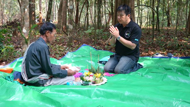
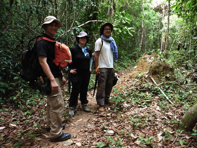
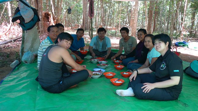
Members of the NSC AU has been involved with the Bukit Brown Cemetery Documentation Project since 2012, particularly in artifact cataloguing and ensuring conservation protocols. The project is currently ongoing and AU personnel are on site weekly to assist with the documentation and processing of artifacts.
There was a free travelling exhibition in Singapore regarding this project entitled Bukit Brown: Documenting New Horizons of Knowledge (which were held at several Singapore public libraries from 19th July 2014 to 31 Jan 2015).

(L-R): Mr. Lim Chen Sian (AU), Mr. Michael Ng (AU), Mr. Aaron Kao (AU), Mr. Desmond Lee (Minister of State for National Development (Singapore)), Dr. Hui Yew-Foong (ISEAS), and Ms. Foo Shu Tieng (AU) at the Bukit Brown exhibition launch on 19 July 2014. (Credit: Bukit Brown Documentation Project)
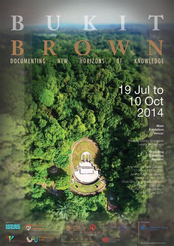
Bukit Brown Exhibition poster (Credit: Aaron Kao)

Fort Speelwijk excavation in 2011. (Credit: Lim Chen Sian)
Site Information
The Sultanate of Banten was one of the largest coastal settlements in the Malay Archipelago in the mid-2nd millennium; it’s spectacular rise and demise signals the end of a series of the port cities that once monopolized the trade in Southeast Asian produce and natural resources. Today, the ruins of the famous palaces and fortifications from the golden age of Banten are still visible and visited by thousands of tourists every year. Surprisingly, very little archaeological research has been undertaken at this once powerful trading emporium.
Banten’s history consists of a complex narrative involving trade, political change, and cultural interactions. Banten was the largest city in the East Indies during the 16th and 17th centuries, where the Portuguese, Dutch, English, Japanese and Chinese were amongst many who established trading stations in the cosmopolitan port.
Project Information
The Banten Lama research focuses on the daily life-ways and interaction between the multifarious populations in ancient Banten. The archaeological investigation at Banten Lama is collaboration between the Pusat Penelitian dan Pengembangan Arkeologi Nasional Indonesia (the Indonesian National Centre for Archaeology), the Department of Southeast Asian Studies (National University of Singapore), and Department of Archaeology (Boston University). There have been three annual seasons since 2009; from 2012, the project will be spearheaded by the ISEAS Archaeology Unit. The principal archaeologists for the project are Sonny Wibisono, Naniek Wibisono, and Serji Yanto from the Pusat Arkeologi; Kay Ueda of Boston University; and Lim Chen Sian (NUS SEAD, ISEAS AU).

The exterior of Fort Speelwijk. (Credit: Lim Chen Sian)
Visit the 2011 Season Project Log created by the student participants: http://archaeologybantenlama.wordpress.com
Project Information
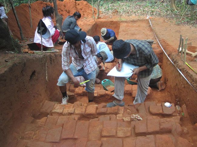
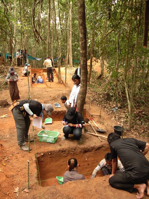
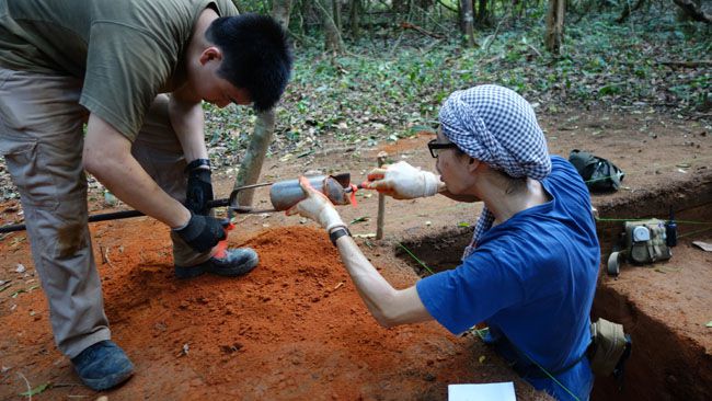
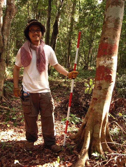
A preliminary archaeological investigation was conducted at the Banteay site on Phnom Kulen between 26th of April – 8th of May 2014 as a joint cooperation project between what was then known as the Institute of Southeast Asian Studies (ISEAS) (now ISEAS – Yusof Ishak Institute) and the Autorite pour la protection du site et l’amenagement de la region d’Angkor (APSARA Authority (Authority for the Protection and Management of Angkor and the Region of Siem Reap)).
This initial phase of research involved a survey of the area and the excavation of six trench units. The research at the Banteay site was meant to try to locate habitation sites and to understand the structure of the terraces. The excavations revealed what may be a staircase accessway made from bricks, earthenware pottery sherds, and burnt clay features. Soil profiles from excavated trench units also revealed how compound’s terraces may have been constructed and reinforced differently from later periods. The results of the excavation was presented at the Technical Session of the International Coordinating Committee for the Safeguarding and Development of the Historic Site of Angkor (ICC-Angkor) meeting in 2015.
THE TEAM
Technical Supervisors
H.E. Seung Kong (APSARA), H.E. Tan Boun Suy (APSARA), and Dr. Derek Heng (ISEAS)
Principal Investigators
Dr. Ea Darith (APSARA) and Mr. Lim Chen Sian (ISEAS)
Technical Staff
Mr. Cheang Sokuong (APSARA), Mr. San Renovann (APSARA), Mr. Sorn Chantharn (APSARA), Mr. Hem Mike (APSARA), Mr. Chhut Radet (APSARA), Ms. Foo Shu Tieng (ISEAS), Mr. Michael Ng Jian Cheng (ISEAS), Mr. Aaron Kao Jiun Feng (ISEAS)
Project Consultant
Dr. John Miksic (ISEAS)
Students
Ms. Sok Chanthida, Ms. Suos Phalla, Mr. Thy Sereyvuth, and Mr. Sokha Panha
Cambodian Workers
Pa Lunh, Khern Tharm, Chham Charn, Heng Hour, Hor Phai, Aum Varn, Sot Sothea, Moeun Tou, Heng Sreyroth, Prun Nhes, Prun Nheay, Prun Saki, Sat Larm, Khoeun Sreyneth, Surn Seurm, Chin Chem, Sem Veit, Ry Pheap, Thy Savry, Lon Meng, Pheap Sophal, Chan Rotha, So Reach, Yoeun Sreydeng, Phat Phen, Hap Chhev, and Neng Lon.
Image gallery


The Adam Park excavation. (Credit: Lim Chen Sian)
Site Information
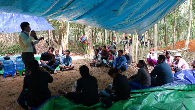
Seventy years ago in February 1942, some of the most ferocious fighting in the Pacific War took place amidst the well-manicured lawns of a quiet suburb in Bukit Timah. At Adam Park, the Cambridgeshires – a novice British infantry battalion – was thrown into the thick of fighting in the epic Battle of Singapore. Miraculously, for four grueling days the Cambridgeshires held their ground and stood firm against the elite Japanese 41st Regiment’s onslaught, fighting until finally ordered by the High Command to lay down their arms.
Project Information
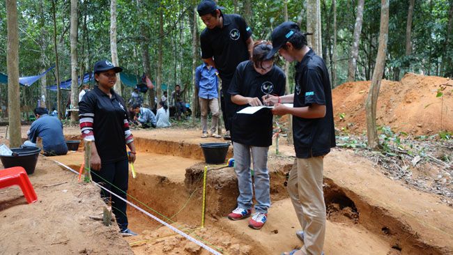
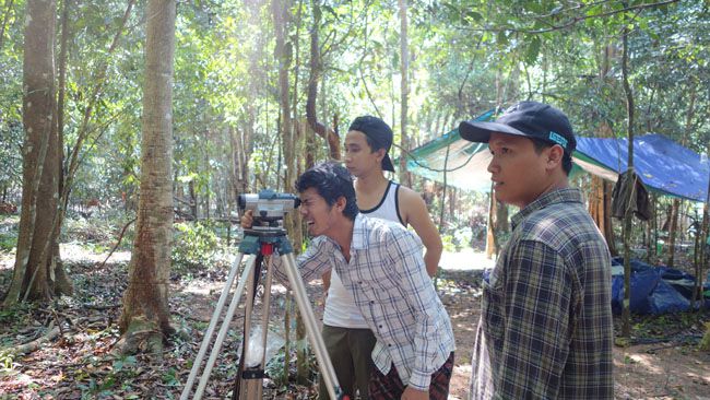
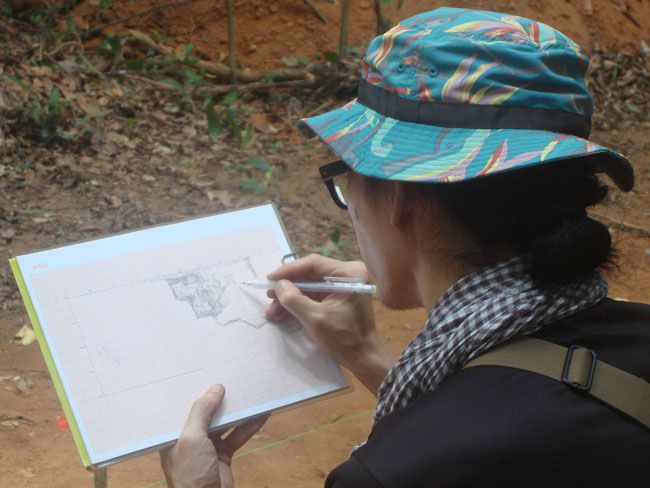
Between May 2010 and April 2011, Mr. Lim Chen Sian led an archaeological team to conduct an archaeological survey of the Adam Park battlefield. The Adam Park project presented an opportunity for archaeologists in Singapore to experiment with the methods and theories that had been successfully deployed elsewhere such as World War I battlefields in Europe. Battlefield archaeology is a unique branch of the archaeological discipline and involves the investigation of a very specific event involving conflict and fighting. The project also included architectural historians and conservators in the search for a chapel created by the POWs after the battle. The project was co-organized with the Singapore Heritage Society.
The archaeology team conducted topographic mapping at Adam Park. (Credit: Lim Chen Sian)
Mr. Lim Chen Sian curated the “Four Days in February: Adam Park the Last Battle” exhibit (8th February 2012 to 24th June 2012) at the National Library of Singapore, based on findings from the project. The launch in February 2012 also marked the 70th anniversary of the fall of Singapore, an event so tumultuous that Winston Churchill spoke of it as the “worst disaster and largest capitulation in British history.”
Related